
Date completed: 13th November 2014.
Weather conditions: Dry, but cloudy grey skies, and a chill, brisk wind. Novembery, in other words.
Summits bagged: All of the seven summits that pack themselves into the Naddle Horseshoe chapter of The Outlying Fells. This is the most Wainwright summits I have so far done in a single-day walk, and it’s a notable contrast to the previous walk, walk 88, which was twice as long and had only one summit on it.

Start and end points: Started and finished in Burnbanks. This is, once a week only, served by a bus which runs from Langwathby and Eamont Bridge. As this does not go through Penrith in the morning I also needed to walk to Eamont Bridge from Penrith station, which took about 25 minutes.
The walk fitted, with about twenty minutes to spare, into the gap between the 10:00 arrival and the 14:15 departure. Which is just as well, seeing as these are the only public transport options.
Distance walked: 7 miles approximately. To this should be added approximately 1.5 miles’ walking from Penrith station to Eamont Bridge in the morning, to catch the Haweswater bus. I didn’t have to do this on the way back though, as I persuaded the driver to drop me back at Penrith station.
Total ascent: 1400 feet approximately.

Pub at end: There are no refreshments available in Burnbanks. The nearest pubs are to be found a mile-and-a-half away in Bampton or Bampton Grange. The bus passes both so if you do the walk a bit quicker than me you might have time to drop in. Otherwise, Penrith. Or Preston station.
Route: This is an easy walk relative to the number of summits bagged. However, I admit I had higher hopes for it than it manifested, although I did it on a pretty chilly November day and on a fine sunny day in August it might be perfect.There are no real highlights however — I hoped for dramatic views of Haweswater but they never really appeared. Routefinding is easy insofar as, in clear weather, the general direction to the next objective is always obvious, but paths do not sustain themselves all the way round, and much of the way between Harper Hills and Hugh’s Laithes Pike is awkward.
The bus, when it runs (currently Thursdays only), drops you by the ‘village green’ around which the bungalows of Burnbanks cluster. The village was built in the 1930s to house the navvies working on the Haweswater dam. None of the buildings left are the originals, though the cottages which remain have been built in the same style.

From here take the signposted ‘Coast to Coast’ path through the woods to Naddle Bridge, cross that and then bear left off the road up the drive of Naddle Farm. This establishment had a vast number of cars parked there when I passed, and is run by the RSPB (Royal Society for the Protection of Birds), taking guests for working holidays. Go through the yard and up the lane behind; look left at this point and you will see the Haweswater aqueduct crossing the beck. This takes water from the reservoir all the way to Manchester, and by gravity only, without the use of pumps.
Turn left just after, down the bridleway signposted ‘Swindale’, cross the stream and then follow the path up to the ridge. Once through the gate at the top, Scalebarrow Knott is visible on the left, and you have basically joined the route described in Wainwright’s Naddle Horseshoe chapter (technically, you have been following it since Naddle Farm), though will need to backtrack after making the short trip to the first of the day’s seven summits.
The path is good from Scalebarrow Knott over Harper Hills, summit 2, and hopes will be high that the whole of the route will be this easy. Alas, it is not. There seems no obvious point to leave this path for the ascent of Hare Shaw that is better than any other, and no route which will avoid awkward and boggy ground on the way up. If there is, I didn’t find it. Hare Shaw is the summit of the day, and some low crags around the top mean you do need to exercise a little care on leaving it.

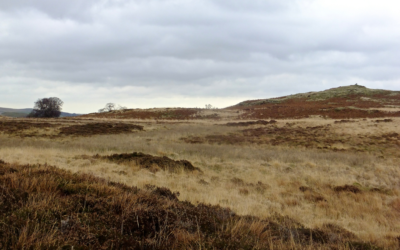
The general route has been obvious all the way round, but as one descends from Hare Shaw and heads for the northern of the two ridges that bound the Naddle valley, paths come and go and the ground is a patchwork of heather, boggy bits, tussocky grass and the occasional rock. It’s as awkward to walk on as it sounds. I tried to stick to the height of the ridge mainly because I thought this would offer the best views of Haweswater below, but though the lake (OK, reservoir) is seen, the sight is nothing to write home about. The most dramatic part, Mardale Head, is not in view. It might be worth considering sticking to the path below the ridge, as long as you bag the cairned summits, of which four are knocked off in fairly quick succession. Hugh’s Laithes Pike, the penultimate summit, does have a good aerial view of the Haweswater dam (pictured), though it’s an impressive rather than picturesque sight.
From the last, unnamed summit, steep ground and forest preclude a direct descent to Haweswater. Follow the advice given in Wainwright, and loop round to the south-west instead, taking care not to descend too quickly once through the first fence. Easy paths are to be found by heading more up-valley (but downhill), until a path is picked up which becomes the farm track, gaining substance as height is lost, and eventually leading back through Naddle Farm to the road, and Burnbanks.

Almost wholly political commentary: After four and a half years in power the right-wing government which seized power in the UK following the indecisive 2010 election has just six months left to get as much asset-stripping done as it can manage. One particular fear of mine has indeed come to pass — the Penrith – Shap – Kendal bus is no more. It has ceased to be, it is an ex-bus service. Shap, a habitation of around 1,200 people, which until the end of October had half a dozen buses a day linking it to both Penrith and Kendal (which have train stations), now has one bus a week.
Let me just say that one again. That’s a place that is home to more than a thousand people, and it has gone down from several buses a day, to one a week. And this is entirely down to decisions made by those in power. This is appalling neglect.
I mean, what’s the actual point of this? Has the tax burden eased under the ConDems? Unless you’re very rich — in which case it will have noticeably reduced — I can’t say I’ve noticed. And the rhetoric about reducing the ‘national debt’ is pure wind, because it hasn’t dropped a bit (check the figures if you don’t believe me). However, those who can call on large amounts of private capital have done very well out of the last few years. In short what has happened is a vast, and ongoing transfer, of publicly-owned assets to the private sector. That was the motivation for the 2010 coup d’etat, and even if (and unbelievably, it’s still in doubt) the regime changes again in 2015 there is little hope of most of what was sold off being reacquired.
The sell-off was not necessarily direct. Look superficially at the bus services of Cumbria and most places of consequence are still reasonably well-served. Ambleside, Keswick, Grasmere, Cockermouth — there has been no obvious decline in these services. Yet this is a consequence of the way that the sector is carved up and disguises the true situation. The corporate, private operators — and in Cumbria, this means Stagecoach (run for the profit of a man who then directs chunks of this income to right-wing and homophobic political causes) — can cherry-pick the profitable routes, the ones that will have passengers either all year (e.g. Kendal-Windermere-Keswick, Penrith-Keswick-Cockermouth) or are worth scheduling in the summer when there are more walkers around (like the Keswick-Buttermere-Honister bus).

But for the rest of the district, as with other more remote, rural areas of the country, these services have historically been supported by a certain level of subsidy from both local and national government. What this basically means is that, indirectly, profits from the core routes are redistributed in order to support the more peripheral services.
For a long period of time this has been an arrangement which has worked quite acceptably. Unfortunately, any notion of ‘redistribution’ is now anathema to the unelected idiots who seized the reins five years ago. Directly, their policy is to starve local government of the funds they need to support services (though I do not entirely absolve the decision makers at council level of blame: they too pick on easy targets when it comes to making cuts); indirectly, the mindset they promote wants to push us into our cars, which are great extractors of capital in various ways (beyond the excessive amounts of cash poured into marketing cars as desirable consumer items there are many ways to raise tax with them, including fuel duty, road tax, VAT).

The ‘Fellrunner’ bus I caught today (pictured) is now the only way of getting anywhere near the eastern side of the district by public transport — meaning the whole swathe of land, several dozen square miles, that lies between Kendal and Penrith and includes the Haweswater basin and the Shap Fells. This service is one of several run by a company based in Langwathby and which is run on a voluntary basis. The main source of income, which covers fuel and maintenance costs for the buses, is the remaining central government support for concessionary fares for OAPs, plus the few cash fares collected when some mad walker like me negotiates all the logistical transport problems put in his way and makes it onto the bus in the morning. The drivers and administrators are all volunteers.
Doubtless our Prime Minister (who has yet to actually win an election, remember) would see this as epitomising the ‘Big Society’, a phrase he was very keen on back in those halcyon early days, but which we are no longer regaled with very much. And perhaps it is. But looking at the bigger picture what it also is, is the removal of services from places like Shap, and their replacement — by default — with private sector alternatives. it’s asset stripping. And it stinks.

Could it be different? Yes, I believe it could. It becomes a vicious circle after a while — services to an area are poor, so people don’t believe they’ll be useful to them, and so plan their journeys using other methods, so aren’t on the buses or trains, so claims can be made about low levels of use and so the service declines further. These were the tactics used in the 1960s to close rail lines under Beeching, and they’re happening again.
But local councils, even when being cynically and ideologically starved of funds, can still exercise their regulatory role more aggressively. Despite recent improvements, caused entirely by the introduction of the 0758 Trans Pennine Express service from Preston to Penrith, there are still too many examples in the Lakes of awful connections, where for want of a little attention to the timetable, things could be made a whole lot more convenient for travellers. In that some of these are so blatantly poor, I half-suspect the neglect is deliberate.
I did talk to the driver of the bus this morning and asked him why they didn’t a) route it past Penrith station, instead of forcing me to yomp out to Eamont Bridge (a 25 minute walk) as a prelude to the main event and b) then advertise it specifically to walkers, highlighting the fact that this was their best route to Haweswater. He said that the company had considered this but concerns had been expressed that if the bus filled up with walkers — and being volunteers they need to restrict the service to 16-seat minibuses, which can be driven without a special license — they would then not be able to accommodate the pensioners who live in Bampton and Burnbanks and obviously use the service every week: there were several on it today. (As an aside, it doesn’t help that even the Wainwright chapter that I followed today declares that the ‘starting point of the walk is remote from bus services’ — no it isn’t…. not yet anyway.)

What this highlights is the issue of capacity as well as scheduling. Increasingly heavy limitations that are squeezing accessibility out. Why should I, or anyone else, be forced to use a car? Aren’t enough problems caused by excessive loads of cars in remote and beautiful parts of the District, like Seathwaite, Mardale Head, Buttermere? Isn’t it worth a small investment of capital in supporting sustainable solutions and at least offering an option? This isn’t naiveté, it’s a sensible plea for diversity, a recognition that it’s simply stupid to throw all the eggs in one basket.
Enough of this. But I predict that if the right wing steal the election again in 2015, expect most of the edges of the Lakes to be inaccessible by public transport within two years.

And the walk? Yeah — it was OK. November, y’know? It picked up 7 of the remaining summits in one fairly easy round, but that economy was its major selling point: the views of Haweswater were not as good as I hoped and there was a lot of difficult ground. Still, it was also good fresh air and it got me out of the office. Nor was it a completely solitary experience, as expected: I was basically one summit behind two other walkers all the way round, and there seems to be quite a community centred on Naddle Farm at the centre of the route. I passed a couple of guys after juniper berries on Hugh’s Laithes Pike (‘of course they’ve brought forth juniper berries! They’re juniper bushes!!’).
This might be the last one in 2014, I can’t say for certain yet. I’d like to get one in December but it depends on other commitments and, obviously at this time of year, the weather. There won’t be any extra buses by then, but maybe over the next couple of years those in power will start to see sense. Or is that a flying pig heading over the summit of High Street to the south?

[…] and (relatively) polite rant about this have a look at the commentary for today’s walk, walk 89. You could, of course, also read this page to hear about the walk I did, which in highly economical […]
I was in the Lakes myself this day, having had to plan trains and coaches like a military expedition from Manchester to give myelf just over four hours in Keswick. You must have been on the Horseshoe when my train passed: at least you avoided the horrendous rain of the later afternoon.
Only just — the rain started while I was on the bus, 15-20 mins after it picked me up from Burnbanks.