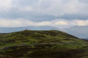
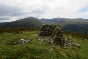
Height: 1696 feet above sea level is the height quoted in Wainwright, but on page 5 of the first edition of his chapter he disputed whether the summit originally surveyed at that height — the western of the two candidates — is actually the highest point of the fell, saying that the top further east looks as if it may be higher. Later surveys have vindicated that view, as a spot height is now quoted on the OS map at 1722 feet (525 metres). This summit has a cairn on it and can be treated as the summit of the fell.
Nevertheless, the western top certainly looks as high when you’re up there: but checking the map later shows that it is, indeed, 26 feet lower, with a spot height of 517m (that is, 1696′). I would still visit this top, however, as it has a better view, particularly of the valley of Hobcarton Gill and the Vale of Lorton.
Volume: Book 6 (The North Western Fells)
Date climbed: First visit: 3rd June 2010 (walk 18).
Second visit: 2nd October 2020 (walk 184).
Bagged as number: First round: 59 out of 330. [ << Ling Fell (59) (60) Rosthwaite Fell >> ]. Second round: 261 of 330. [ << Lord’s Seat (260) (262) Armboth Fell >> ]

Whinlatter in its August plumage (thanks to heather); Broom Fell (left) and Lord’s Seat behind it. As seen from Hopegill Head.
Route of ascent and descent: First visit: Climbed from, and descended to, the Whinlatter Forest Visitor’s Centre. We then extended the walk down to Thornthwaite and Braithwaite, a beautiful walk through the woods and highly recommended.
Second visit: Came over from Lord’s Seat. Wainwright specifies this route is possible on page Whinlatter 6, and so it is, but note that at one point it requires you to use a path that is specified as only for mountain bikes, so do take care there. Descended to the Visitor Centre again.
What Mr Wainwright says (from page 4 of his chapter): “Whinlatter tempts few walkers, the steep slopes of heather and scree above the Pass being too rough to contemplate, but the crest of the fell is entirely different — a delightfully undulating ridge, a joy to walk upon. It can be attained, moreover, by the simplest of gradients if the direct climb alongside the fence is disregarded in favour of the helpful forest roads… the whole of the walk then being no more than an hour’s ramble.”
What I say: In AW’s day the forest visitors’ centre did not exist. Its presence has greatly added to the number of visitors – and mountain bikes – which will be encountered in the plantations. However, once out on the open fell you may well have it to yourself. It is hardly a dramatic fell but the walking is easy and the views of Grisedale Pike very good. It’s probably worth a visit when the heather is out in bloom.
As noted, I would visit both tops. Wainwright suggests on page 6 that Derwentwater can be seen from the eastern (true) summit, but this is not the case: it can be seen from further east along the ridge, however. Note also that according to advice given in the visitor’s centre, there is no public access to or egress from this fell at its western end, near Darling How farm.


[…] 184: Barf (1536′, no. 259), Lord’s Seat (1811′, no. 260) and Whinlatter (1722′, no. […]